
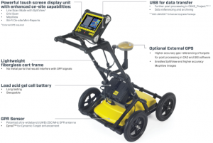
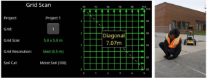
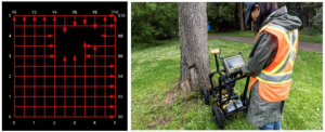
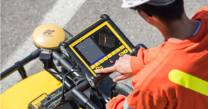
Public utility systems and local governments require that the positions of underground systems are located and marked. This helps in planning projects and avoiding risks and hazards. The LMX200™ builds on the capabilities of the LMX100™ and adds further features to help you locate and map these utilities. It adds the powerful Grid Scan mode and the ability to use an external GPS to take full advantage of SplitView and MapView. The LMX200™ Enhanced upgrade also allows data export for post-processing, archiving, reference and further mapping capabilities.
LMX200™ Features
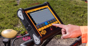
In-field visualization features
EKKO_PROJECT™ PC software
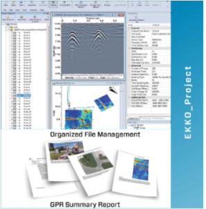 Data exported from LMX200™ Enhanced uses the EKKO_Project™ PC Software for Data Management, Display, Archiving and Reporting.
Simple GPR project organization: Organize GPR lines & grids, add photos and other files, and save everything in a single project file.
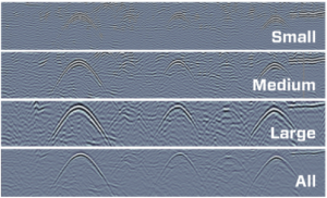
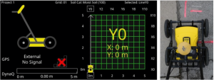
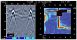
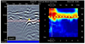
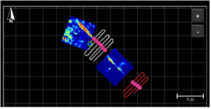
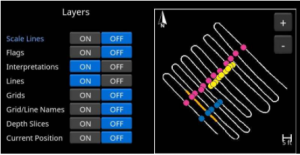
View GPR data: View GPR lines and depth slices. Slice through multiple grids simultaneously and add background images to MapView.
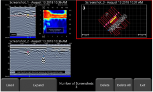
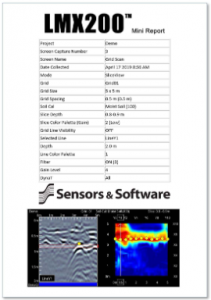
Create Impressive Reports: Quickly save data as graphic image files (.jpg, .bmp, .png). Automatically create summary reports with data, photographs and text and export as a PDF.
Optional EKKO_PROJECT™ Utility Suite
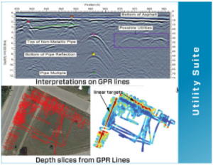 With the optional EKKO_Project™ Utility Suite gain access to:
LineView, SliceView and Interpretation modules. to :
- Modify line views and depth
- slices
- Process GPR line surveys into depth slices
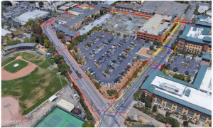
- Export depth slices into Google Earth™
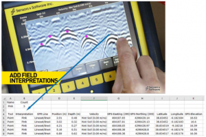
- Add point, polyline, box and annotation interpretations to GPR lines
Video link: https://www.youtube.com/watch?v=VwNhL2eyfgo&t=2s


Reviews
There are no reviews yet.